
Ten thousand years ago, if you had stood on the floor of what is now the Mojave Desert and looked east toward the Kingston Range, you would not have recognized the land. The valley at your feet — today a parched expanse of creosote and salt flat — would have been the shimmering surface of a lake. The mountains above you would have been fringed with juniper. The air would have been cool. Somewhere in the middle distance, a mammoth might have raised its head from a marsh fed by rivers that no longer exist.
That world is gone. And according to a landmark 1980 survey of cultural and environmental resources in the Amargosa-Mojave Basin — commissioned by the Bureau of Land Management and compiled by a team of archaeologists and historians from the University of Nevada, Las Vegas — it vanished with extraordinary speed. What had taken tens of thousands of years to build — a network of interconnected lakes, forests, rivers, and grasslands stretching across two and a half million acres of southeastern California — unraveled in roughly two thousand years. By 7,500 years ago, by most measures, the desert we know today had arrived.
The story of that collapse is one of the most dramatic environmental transformations in the recent geological record of North America. It is told not in written history but in the language of ancient shorelines, buried sediment cores, fossilized pack-rat middens, and the preserved dung of creatures that walked this land when it was still lush. And it raises a question that haunted the researchers who compiled it, and haunts anyone who reads it today: what does it mean for a world to end?
A Landscape Built on Water
To understand what was lost, one must first understand what existed. During the height of the last glacial maximum — roughly 23,000 to 17,000 years before the present — the Mojave was a fundamentally different place. Average temperatures ran some eight to fifteen degrees Fahrenheit below modern levels. Rainfall was substantially greater. And because the great Cordilleran and Laurentide ice sheets to the north blocked the flow of cold Arctic air, winters were paradoxically mild, allowing moisture-laden storms to penetrate deep into what is now an arid interior.
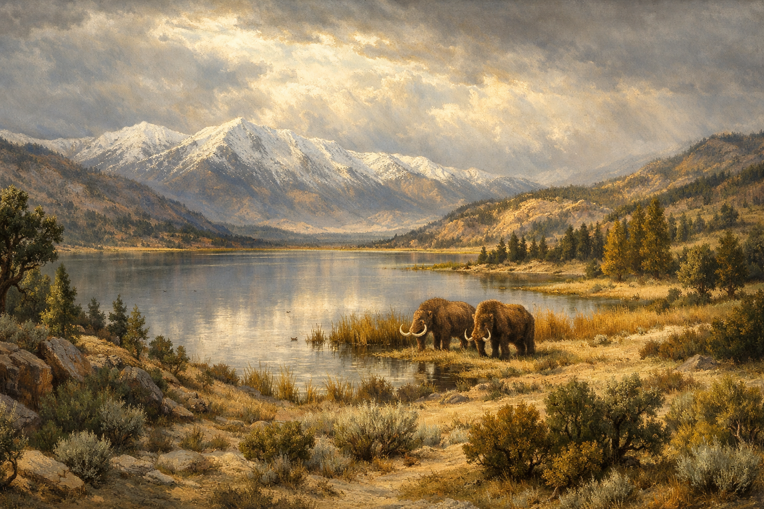
The result was water — an abundance of it that is almost impossible to conceive standing in today’s desert. Searles Lake, located just west of the study area, filled its 680-foot basin to overflowing, sending water cascading south into Panamint Lake and onward into Lake Manly in Death Valley. Lake Mojave — the ancient predecessor of what are now the Soda and Silver dry lakebeds — stretched across the valley floor at depths modern researchers have reconstructed from tufa formations and radiocarbon-dated shell deposits. Lake Manix, fed by the ancient Mojave River, held high stands between 30,000 and 16,000 years ago. Dozens of smaller basins — Cronise, Broadwell, Silurian, Ivanpah, Mesquite — held their own lakes, presumed by researchers to have followed a broadly similar pattern.
These were not isolated puddles. They were connected by flowing rivers into a hydrological system of continental scale, fed from the glaciated peaks of the Sierra Nevada and surrounded by vegetation zones that had migrated thousands of feet downslope from their modern elevations. Pollen records analyzed from sediment cores at Searles Lake showed woodland communities growing four thousand feet below where they grow today. Juniper trees, which now require substantial elevation, once rimmed lake basins now far below the tree line. Joshua trees, as evidenced by the stomach contents of fossilized ground sloths found in Gypsum Cave — dated to between 12,000 and 8,500 years ago — grew in the lowland valleys.
“During the last pluvial many basins, now dry and salt encrusted, were fed to overflowing by cool waters and joined by great rivers. As woodlands descended to the treeless deserts, glaciers carved beds in the snow-capped mountains. Herds of camels, horses and mammoths grazed the steppes and fertile marshes.” — P.J. Mehringer, 1977
The Unraveling Begins
The first sign of instability came around 12,000 years ago. Lake Mojave and Searles Lake, the two best-documented systems in the region, both record a period of desiccation — a sudden lowering of water levels that, in some interpretations, saw Lake Mojave go temporarily dry. It was brief. Within a thousand years, both lakes surged back. Searles overflowed between 11,000 and 10,000 years ago; Lake Mojave records an overflow period lasting from 11,000 to 9,000 years ago, and even preserves evidence of an anomalous wet episode as late as 8,500 to 8,000 years before the present — a last gasp of the pluvial conditions that had shaped the region for millennia.
But the recovery was illusory. Around 11,500 years ago, the great ice sheets that had for so long reorganized the continent’s atmospheric circulation began to open. An ice-free corridor formed. The cold northern winds that the glaciers had blocked now swept south. The weather patterns that had delivered abundant winter moisture to the Mojave shifted. The Pacific High Pressure system strengthened. And the conditions that had sustained the lakes, the rivers, and the forests for tens of thousands of years quietly began to fail.
What followed is described in the 1980 report with a starkness that still resonates. Citing the synthesis of the paleoclimatologist P.J. Mehringer — whose 1977 review of environmental change in the Great Basin remains the foundational document in the field — the authors write that within approximately two thousand years, beginning around 12,000 years ago and completing by 10,000, the transformation was essentially total. Lakes shrank. Rivers ceased to flow. Springs began to dry. The plant and animal communities that had defined the region retreated northward and to higher elevations. And the great mammals — the camels, the horses, the mammoths — did not retreat. They disappeared.
The Silence After
By 7,500 years ago, Mehringer concluded, conditions were much like those of today. The creosote bush — adapted to heat and drought, able to survive on as little as three and a half inches of annual rainfall — had become the dominant plant of the valley floors. The lakes were gone, their former surfaces marked only by salt-encrusted playas and the ghost outlines of ancient shorelines preserved in bands of tufa on the hillsides above. The rivers had become arroyos: dry, intermittent, and prone to flash floods when the rare storm moved through.
The collapse was not, strictly speaking, uniform or instantaneous. Mehringer and the authors who drew on his work were careful to note its complexities: a possible brief return to greater moisture between 6,500 and 5,500 years ago; another minor wet episode between 4,000 and 3,000 years ago, when minor lake rises were recorded at Searles Lake and Death Valley. The picture that emerges is less a single catastrophic moment than a cascade of changes, each one ratcheting the system a little further from equilibrium — and each one making the return to a wetter state a little less likely.
For the human populations who lived through this transition, the consequences were profound. The archaeological record of the Mojave Desert records a dramatic cultural shift coinciding with the desiccation. The Lake Mojave Period — characterized by native people who camped along the shores of Pleistocene lakes, hunting large game and exploiting the rich ecological edges where woodland met water — gives way to the poorly-understood Pinto Period. Some researchers have suggested the evidence points to a near-total depopulation of the lowland desert during the driest millennia, a complete hiatus in the cultural sequence. Others argue for a sparse, adaptive continuity. The debate, the authors note, remains unresolved.
“By comparison, all subsequent environmental changes have been minor.” — Mehringer, 1977, on the collapse of the pluvial lake system
What the Desert Remembers
The evidence for all of this is written in the land itself, in forms that require specialized instruments and trained eyes to read. Sediment cores bored into the floors of dry lakebeds reveal alternating layers: dark, organic-rich muds laid down when lakes were permanent and deep; pale, saline silts deposited when the water was shallow or gone. Radiocarbon dates on shells and tufa formations provide an absolute chronology. Pollen grains preserved in lake sediments record the shifting composition of plant communities across tens of thousands of years.
Pack rats — those meticulous, inadvertent archivists of natural history — contributed an entirely different line of evidence. Their middens, built stratigraphically over centuries of sequential habitation, preserve twigs, seeds, bark, and plant matter gathered from within fifty yards of the den, solidified in urine and virtually indestructible across millennia. By 1980, researchers had analyzed dozens of Mojave middens, and the picture they assembled confirmed what the lake records suggested: woodlands at dramatically lower elevations during the glacial maximum; a steady upslope retreat as temperatures rose and rainfall declined.
The fossilized dung of ground sloths — large, lumbering herbivores that browsed the Mojave lowlands until roughly 8,500 years ago — offered a final, vivid line of evidence. Analysis of their botanical remains, recovered from caves in the region, showed a diet composed overwhelmingly of Joshua tree. The Joshua tree now grows at much higher elevations than where those caves are located. The sloths ate it in the valleys. And then the sloths were gone.
A Reckoning
The 1980 report was compiled as a planning document — a resource inventory intended to guide land management decisions across millions of acres of California desert. Its authors were archaeologists and historians, not climate scientists, and their purpose was practical. But the paleoclimate chapter they assembled, drawing on the work of geologists, palynologists, and paleobiologists, amounts to something more: a portrait of radical environmental impermanence, drawn in rigorous scientific language, laid across a landscape that most visitors experience as timeless.
There is something quietly unsettling about that portrait. The Mojave does not look like a place that was, ten thousand years ago, full of lakes and forests and megafauna. It looks the way deserts look: ancient, desiccated, and permanent. But the science assembled in this report insists otherwise. The desert is young. Its dryness is recent. And the great biological community that preceded it — the lakes, the mammoths, the juniper forests growing where creosote now grows — was erased in what amounts, in geological terms, to an eyeblink.
The authors cite Mehringer’s summary as the best developed statement of climatic and environmental change available. His conclusion — that all subsequent environmental changes, compared to the collapse of the pluvial system, have been minor — carries an implicit warning that the researchers did not belabor. The land can change. It has changed before, suddenly and completely. The salt flats and dry lakebeds of the Mojave are not the floor of an ancient desert. They are the tombstones of an ancient sea.
Figure 01
Based on lacustrine and palynological evidence synthesized by Mehringer (1977) and Warren et al. (1980). Lake level data: Ore & Warren (1971); Smith (1968). Temperature estimates from palaeobotanical reconstruction, Martin (1965). The anomalous Lake Mojave wet pulse (~8,500–8,000 BP) is documented by Ore & Warren (1971) and has no clear parallel in other regional records.
Figure 02
Bar lengths represent approximate relative lake volume, not absolute depth — they are schematic, derived from qualitative descriptions in Warren et al. (1980) and cited sources. Lake Manix levels are partially inferred from Searles Lake correlations (limited direct dating). The anomalous 8,500–8,000 BP resurgence at Lake Mojave appears in no other regional lake record and remains unexplained.
Figure 03
- Columbian MammothGrazed steppe grasslands; gone by ~10,000 BP
- Ancient Horse & CamelNative American species; extinct by end of Pleistocene
- Ground SlothBrowsed Joshua tree in valley floors until ~8,500 BP (Gypsum Cave evidence)
- Juniper & Pinyon WoodlandGrew 4,000 ft below modern elevations; rimmed lake margins
- Joshua Tree (valley floor)Occupied lowlands — confirmed by ground sloth diet analysis
- Interconnected Lakes & RiversSearles, Mojave, Manix, Panamint — linked by flowing drainage
- Creosote BushDominant plant; survives on 3.5 in/yr rainfall across valley floors
- Salt Flat & PlayaFormer lake beds; ancient shorelines preserved as tufa bands on hillsides
- Saltbush ScrubAlkali-tolerant species occupying former lake margins
- Joshua Tree (elevated)Retreated upslope; now restricted to above ~2,000–3,000 ft
- Pinyon-Juniper (elevated)Restricted to above ~5,000 ft — formerly in valley floors
- Dry Arroyos & Failing SpringsRivers became intermittent; springs began failing ~10,000–8,000 BP
Species data from Warren et al. (1980), synthesizing palynological, coprolite, and pack rat midden analyses. Ground sloth diet evidence: Laudermilk & Munz (1934, 1938); radiocarbon dating by Wells & Berger (1967). Vegetation elevation figures from Martin (1965) pollen analysis of Searles Lake cores.
Figure 04
The four principal lines of palaeoclimatic evidence synthesized in Warren et al. (1980). Each method recovers different environmental signals at different spatial scales — from a pack rat’s 50-yard foraging range to a basin-wide sediment core. Their convergence on a single coherent chronology of pluvial maximum and post-pluvial collapse is the foundation of the reconstruction.
Leave a Reply